Walking Venice - a visitors' guide
Walking routes including St Mark's Square and Santa Lucia station
An overview of Venice for the first time visitor
For the first time visitor to Venice the first thing to emphasise is that there is no road transport. If you thought that all those marketing pictures of the canals of Venice belied the fact there were roads, vehicles and buses out of view - that is not the case.
For the independent visitor, Venice is perfectly manageable with a good map; if however you are restricted for time or would like to have a guide inform your trip to Venice, we show a selection of guided walking tours. See our page Best of Venice Walking Tour.
When you visit Venice you will be exploring by foot, for most supplemented by water transport of one kind or another. It is possible to visit the City of Venice entirely on foot, but there are obstacles to this that makes some use of water transport desirable.
Venice is a collection of islands with the main City of Venice on two islands divided by the Grand Canal. For the tourist the Grand Canal is the beating heart of Venice and most, certainly day trippers, will never venture too far from the Grand Canal.
The Grand Canal
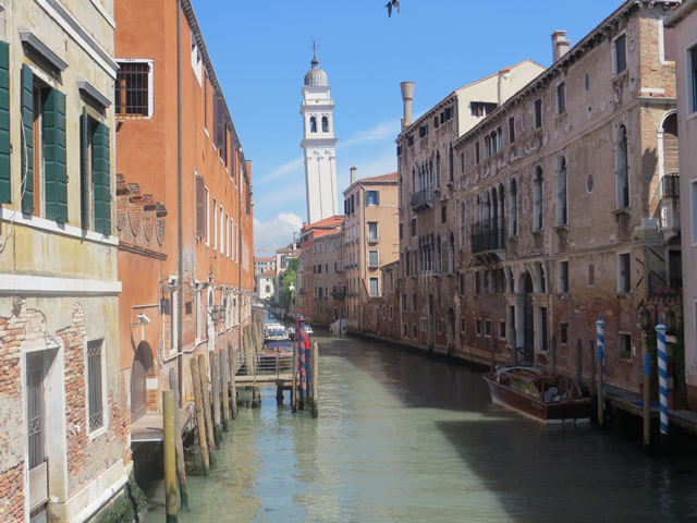
The Grand Canal is 3.8km (2.4 miles) in length and travels in an S shape between the two islands Venice is built upon. The Grand Canal links the entry point to Venice for most (Santa Lucia Railway Station and Piazzale Roma) and St Mark's Square where it spills out onto the open ocean.
Unless you are staying in Venice longer than one day, most will limit their visit to the area between Santa Lucia Railway Station and St Mark's Square.
If you are a typical tourist on a day trip, the itinerary would probably be to head for St Mark's Square by foot or water bus from Santa Lucia Railway Station and take it from there.
Despite the city being split into two by the Grand Canal there are only 4 bridges (footbridges) connecting the two islands. Two bridges are right next to Santa Lucia Railway Station (one connecting the station with Piazzale Roma, where the bus station and car parks are located - literally the end of the road link from the mainland).
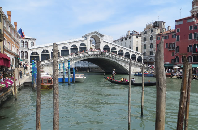
Mid-way between Santa Lucia Railway Station and St Mark's Square is the Rialto Bridge (see image at top of the page), one of the must see sights of Venice and not too far from St Mark's Square at the other end of the canal is the Accademia Bridge.
The water bus route number 1 takes 45 minutes between Santa Lucia Railway Station and St Mark's Square with 14 water bus stops along the way.
If you knew your way (see walking notes below) you could probably walk it in under an hour, but most visitors will take a couple of hours either because there is so much to distract or they simply get lost.
Finding your way around Venice - do you need a map?
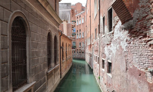
Given that walking around the complex maze of alleys and small bridges is the mandatory way to get around Venice, it is perhaps surprising that signage is so poor. On the main tourist "rat run" between Santa Lucia Railway Station and St Mark's Square there are some signs, but it is easy to miss them.
Perhaps getting lost in Venice is desirable for many, just following your nose you'll make your own personal discoveries around every corner on the main islands. Although there are the tourist hotspots, notably St Mark's Square and the Rialto Bridge, the whole of Venice is equally impressive and going off into the unknown is recommended.
However, sooner or later you'll want to be at a certain place by a certain time in Venice and without a street map you'll become hopelessly lost and frustrated. What looks like a well frequented alley may come to a dead end at a canal water bus stop or water taxi stop, another reason to have a water bus travelcard.
So in short, yes you do need a street map which are freely available including from the tourist office in front of Santa Lucia Railway Station.
Walk between Santa Lucia railway station & St Mark's Square via Rialto Bridge
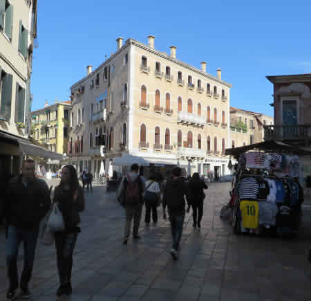
For the first time visitor short on time, the key attractions you will normally head for are the Rialto Bridge and St Mark's Square and normally you will arrive at either the bus station, cruise terminal or Santa Lucia Railway Station all clustered together at the northern end of the main island.
Your options are either to walk or to get the Venice water bus down the Grand Canal. The following few paragraphs outline the main walking route.
St Lucia station/cruise terminal/bus station to Rialto Bridge
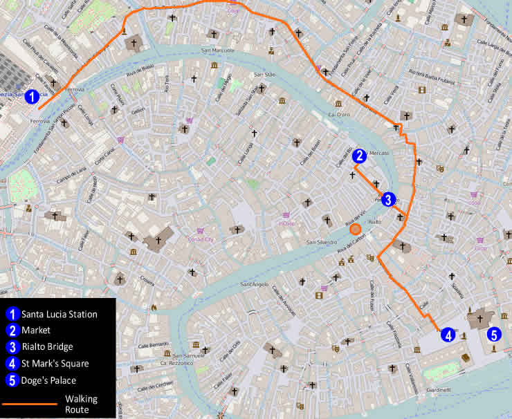
The main walking route between St Lucia Station and St Mark's Square passes the Rialto Bridge. The people mover from the cruise terminal will deposit you in Piazzale Roma, the end of the road from the mainland where the car parks and the bus station is located. From Piazzale Roma you just cross the pedestrian bridge over to St Lucia Station.
With your back to the railway station and facing the Grand Canal with the water bus stops in front of you turn left and follow the wide path parallel to the Grand Canal. A tourist office is here in front of the station where you can pick up a map (for a fee) which is recommended.
Signage is surprisingly very basic and sporadic, just the occasional battered sign at some points whilst at some junctions, nothing.
After leaving the railway station the main pedestrian road veers inland away from the Grand canal, you will only catch glimpses of it now until you reach the Rialto Bridge. The way ahead sets the scene for this section of the walk, a wide pedestrianised street with shops either side.
Along the way you will pass countless restaurants and tourist shops, a couple of supermarkets and a McDonald's.
You are basically following the main route used by the majority and it's a matter of following the crowd, ignoring all side alleys and routes. The way for the most part is wide, lined by shops, but a few small bottleneck sections are narrow and twisty.
The street (Rio Tera Lista di Spagna) leads you to a small square and immediately after you cross a bridge over a major canal.
On the other side of the bridge our way becomes the Rio Tera San Leonardo.
After about 150m the wide street forks and there is no signage. Our way takes the right fork.
You can now go on auto-pilot where the way ahead is obvious, the main shopping street just interrupted by a few points where small bridges cross canals.
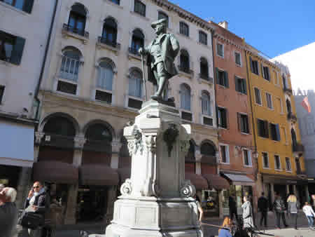
After a Conad supermarket and a McDonald's on your left, keep going straight along the main street until the street kinks left. After the kink, you turn right along with most other people down a narrow section and almost immediately cross a canal, shortly followed by another canal crossing. Another 150 yards and you cross a 3rd canal. Another 100 yards and you empty out onto a small square, (Campo San Bartolomeo) with statue pictured above prominent.
From the Campo San Bartolomeo, take the main turn right and the Rialto Bridge is right in front of you.
Rialto Bridge to St Mark's Square
Resuming our walk from the Campo San Bartolomeo as if we had not turned right to the Rialto Bridge walk straight ahead to the other end of the square and carry on straight forward.
After about 150m ahead after going through the Campo San Salvador you cross over a canal, then take the next left, the Calle dei Fabbri.
Follow the the Calle dei Fabbri straight ignoring all turn-offs and crossing a canal before the path comes to an end at a T-junction. Turn left then immediately right and you are in St Mark's Square.
Venice walking map route between Piazzale Roma / Santa Lucia Railway Station and St Mark's Square via the Rialto Bridge
